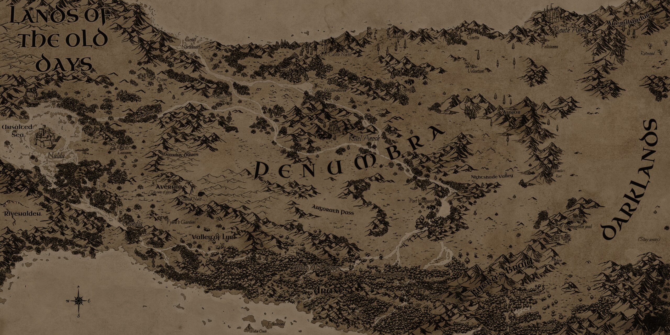
This is the original design for the map of Fyera, created for the Soulmist 5e tabletop role-playing game.
Fyera is a dark fantasy world with strong post-apocalyptic elements, set on a planet that no longer rotates on its axis. The landscape is filled with inhospitable regions, and the few remaining denizens must constantly struggle for survival—whether against the invading forces of the Darklands or each other.
The creator of the Soulmist IP was deeply inspired by The Lord of the Rings and Tolkien’s works as a whole. My goal for this project was to emulate the distinctive look of the Middle-earth map while adapting it to the unique geography of this setting, as outlined in the project brief.
The landmass depicted is roughly the size of a small continent. On the far western edge of the map lie the Lands of the Old Days, a sun-scorched wasteland that remains in daylight year-round. On the far eastern side are the Darklands, a region forever shrouded in darkness.
The Challenges of Mapping Fyera
The foundation of the map was created using Wonderdraft and later refined in Krita, taking approximately a full working week to complete. One of the greatest challenges was achieving a proper sense of scale—especially in regions with dense visual details, such as the southern rainforest-like territory of Draxes. While striving to maintain the aesthetic of The Lord of the Rings movie maps, I had to carefully balance intricate asset placement with overall readability.
Lessons Learned
This was the first map I ever created, and it came with valuable lessons. One key takeaway was realizing that a small number of well-placed assets can effectively convey an environment. For example, a dense forest doesn’t require hundreds of individual tree icons to be visually convincing. While the style I was emulating does rely on numerous assets to depict forests and mountain ranges, I now see the value of using them more sparingly in future projects to improve clarity and efficiency.
Another key lesson I learned was the importance of incorporating more waterways—rivers, streams, and other bodies of water—throughout the map. Given that this represents a vast continent, the relative lack of major rivers makes the landscape feel less believable and distorts the intended sense of scale.
While this map is meant to be an in-universe artistic rendition rather than an accurate navigational tool, small details like additional river systems would have significantly improved its realism and cohesion.
